 |
| 6:15 |
 |
| Pat Mc Gee Trail |
.jpg) |
| One of the typical signs to inform as we walk |
.jpg) |
| Abandoned Train Station in Little Valley |
.jpg) |
| Abandoned Cattaraugus Cutlery Building in Little Valley |
 |
| Plant Check List for Pat Mc Gee Trail |
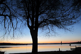
Up at 6:02 for about the third day in a row. The sky is a faint blue, a slight pink or orange above the tree line. I am waiting for the sun to pop up over the Bemus shoreline; it's first edge rises about 7:04. It seems to rise right above my martin house as I sit in my living room, in other words, if I were to walk out my front door and keep going, I would walk in to the sun. It's rising so quickly and brightly, I have to move my chair. Earlier, I walked outside to a frost, a temperature of 25 degrees, crisp and invigorating.
Yesterday, because it was such a beautiful sunny yet cool day, we decided to explore a new trail, The Pat Mc Kee Trail, which runs for 12 miles from Salamanca up through Little Valley to the trail head in Cattaraugus. We too #86 east, getting off at #10, the Steamburg exit, #17, where we could get cheaper gas, at least 20 cents cheaper than here. We then took #10 north to # 242. Then, we took it into Little Valley where we parked behind the County Center building, about 46 miles. Behind the building, we jumped on the trail, obviously an old railroad track, with ties littering the sides of the road along most of the trail. It is well taken care of, would also be a great biking trail because it's smooth, straight, with little ups or downs. It ended up not being our favorite trail, at least the section we were on because it was so straight, with little variance and most was out in open country, not the woods. We had this vision of walking a trail up through winding mountain paths but it was not to be. We walked a total of six miles, three out, three back, to a point just beyond Linlyco Lake, a large pond, hardly a lake. We ended up eating our lunch in town, at the park. The trail did have various signs( called either interpretative or ecological stop)along the road which was really neat, describing the terrain we were walking through, much of it swamp or lowlands. It also described some of the details of the walk, like the lake we passed, the gravel pit, with an explanation of why it was there. We want to do the entire trail, perhaps walking the last half next time, where we actually will hike across the continental divide, where the water flows either east to the Atlantic or west to the Pacific Ocean. We drove home through Randolph, a little shorter, about 40 miles. We left home around 9:30 and returned about 1:15.
I mentioned yesterday that our neighbors had seen loons on the lake. Well, yesterday afternoon, when I was in the front yard, I heard their distinctive call and about 100 yards out, their they were, diving and staying under water for huge lengths of time. They seem much bigger than mallards and buffle heads. It would be a great sound to wake up to, rather than the quack of our resident mallards. I read about them and they are able to dive up to 200 feet. Amazing.
Today, no hikes, as we start to get ready for our trip east on Thursday, to visit the Albarrans for Easter weekend. Evie started making Easter cookies yesterday, to send to Hayden and Halle. We will take them to Marisa's, next week to Marlena's. We have quite a bit of driving over the next three weeks, to Darien and back, then to KC and back. Better than flying.
No comments:
Post a Comment